
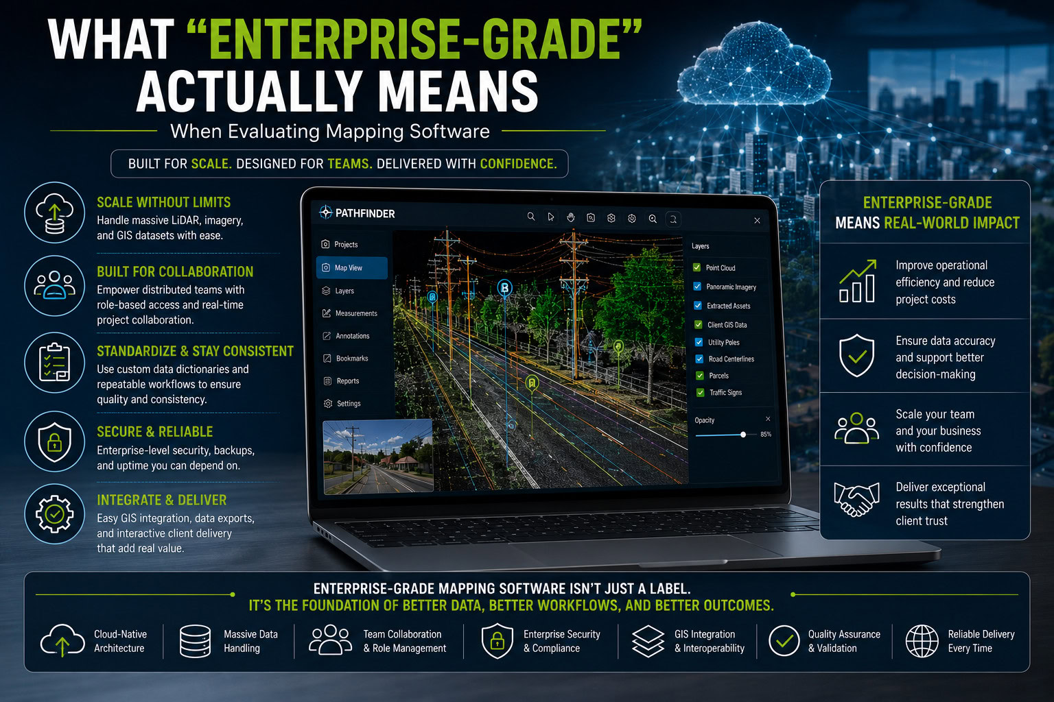
“Enterprise-grade” is one of the most frequently used phrases in technology marketing. Mapping software providers use it to describe everything from cloud platforms to GIS applications and point cloud processing tools.
But what does enterprise-grade mapping software actually mean?
For organizations working with LiDAR, mobile mapping, GIS, infrastructure assets, and large geospatial datasets, enterprise-grade should represent much more than an impressive feature list. The software must be capable of supporting large projects, multiple users, complex datasets, repeatable workflows, and dependable client delivery without creating unnecessary operational bottlenecks.
A platform may work perfectly for one specialist processing a small dataset. The real test comes when an organization needs dozens of people to work across multiple projects, process massive point clouds, maintain client-specific requirements, and deliver consistent results.
Here are the characteristics organizations should consider when evaluating whether mapping software is genuinely ready for enterprise use.
-
Enterprise Software Must Scale With the Data
Geospatial datasets can become enormous.
Mobile mapping projects may combine LiDAR point clouds, panoramic imagery, extracted GIS features, and additional client data across hundreds or thousands of miles of infrastructure.
Desktop workflows can become challenging when every user must download, store, and process these datasets locally.
An enterprise geospatial solution should be designed to handle increasing data volumes without forcing organizations to redesign their entire workflow every time a project grows.
Cloud-based infrastructure can be particularly valuable here. By moving data storage and computational workloads away from individual workstations, organizations can support larger projects while reducing dependence on local hardware, and can add users to a project without adding hardware for each of them.
The I-95 corridor project provides an example of working with large-scale infrastructure mapping data.
Enterprise scalability is therefore not simply about storing more files. It is about maintaining usable performance and holding thousands of miles of organized, accessible data as project size, data volume, and user numbers increase.
-
Collaboration Should Be Built Into the Workflow
Geospatial projects rarely involve a single person.
A large infrastructure mapping project may include project managers, LiDAR specialists, extraction technicians, GIS professionals, quality-control teams, engineers, and client stakeholders.
Enterprise mapping software needs to accommodate these different roles, and it needs to let them work at the same time rather than in sequence.
In many workflows, one team completes extraction before handing the dataset off to the next team for review or use. That handoff model creates delays and version-control problems, since each team is often working from its own copy of the data.
A centralized project environment removes that bottleneck. Multiple teams can work within the same set of data simultaneously, each person accessing the information and tasks relevant to their role, instead of waiting for a handoff before their part of the project can begin.
This becomes especially important for organizations with distributed teams. A cloud-based workflow allows people in different locations to contribute to the same project at the same time, without maintaining separate copies of enormous datasets.
-
Standardization Is Just as Important as Speed
Processing information quickly has limited value if the resulting data is inconsistent.
Imagine an extraction project involving thousands of utility poles, signs, road markings, and other infrastructure assets spread across thousands of miles. If different operators use different classifications or attribute conventions, the final dataset may require significant cleanup before it can be delivered.
Enterprise software should support repeatable workflows built around a single source of truth for how assets are defined.
A data dictionary for asset management workflows lets an entire project, even one covering thousands of miles, be governed by one consistent schema. Every operator extracting from that project works from the same asset definitions and attribute structure, so outputs are standardized no matter how many people touched the data or how large the project grew.
This is especially important for service providers working with multiple clients, because every client may have different GIS schemas, asset classifications, and delivery requirements.
Ranger provides a cloud-based feature extraction environment that supports structured and repeatable extraction workflows governed by this kind of shared data dictionary.
-
Enterprise Mapping Software Must Handle Complex Geospatial Data
A modern mapping environment is rarely limited to one data type.
Organizations may need to work with:
- LiDAR point clouds
- Panoramic imagery
- GIS features
- Shapefiles
- Extracted assets
- Project attributes
- Geographic reference information
The value comes from understanding these datasets together, regardless of how each one was captured.
Ranger is sensor agnostic, which means a single project can combine data collected through multiple methods, such as mobile mapping LiDAR and drone LiDAR, without forcing teams onto separate platforms for each capture method.
Ranger can also ingest previously extracted assets, whether from an earlier phase of the same project or a client’s existing GIS data, and bring them into the current dataset for conflation and reference. That lets new extraction be checked against, and reconciled with, what already exists rather than starting from a blank slate every time.
For infrastructure projects, this can provide valuable context. A point cloud supplies three-dimensional geometry, imagery shows visible real-world conditions, and GIS layers add structured information about assets. Together, they provide a more complete understanding of the mapped environment.
Different projects can also require different data capture approaches. Understanding the differences between mobile mapping LiDAR vs. drone LiDAR can help organizations evaluate which capture method fits their requirements, and a sensor-agnostic platform means that choice does not have to be locked in for the life of the project.
-
Accessibility Should Not Depend on Expensive Workstations
Traditional LiDAR mapping software often requires powerful desktop computers with significant memory, graphics processing, and storage.
That model can work well for specialist users, but it becomes increasingly expensive as teams grow. If every additional employee requires a high-end workstation and a local copy of project data, scaling operations can introduce substantial hardware and IT requirements.
Ranger takes a different approach. It is hardware agnostic, so it does not depend on a specific machine, graphics card, or amount of local storage to run. Anyone with a laptop and a good internet connection can log in and work in the same centralized dataset as the rest of the team, whether they are in the office or working remotely.
Processing and data remain in centralized infrastructure while users interact with projects through a browser-based environment. That makes advanced geospatial workflows accessible to larger, more distributed teams without requiring every user to maintain the same local computing setup.
This shift is part of why enterprise teams are moving to cloud-based feature extraction.
-
Integration and Data Portability Matter
Enterprise software cannot operate as an island.
Geospatial information often needs to move into GIS applications, engineering systems, asset management platforms, and client design workflows.
When evaluating enterprise GIS software or mapping platforms, organizations should examine how easily information can enter and leave the system, and whether outputs can be shaped to fit what the client needs next.
Clients bring extracted data into different stages of their own design process, and each of those next steps often calls for a specific file format, coordinate system, or attribute structure.
Enterprise software should be able to align its outputs to that requirement, rather than handing clients a fixed format and leaving them to convert it themselves before they can move to the next part of their design workflow.
Can existing client GIS data be incorporated? Can extracted assets be exported into the formats a client’s engineering or design team already works in? Can teams work with established data structures rather than rebuilding them from scratch?
Enterprise-grade software should complement an organization’s existing technology ecosystem instead of trapping information inside a proprietary workflow, or inside a format that creates extra work before a client can actually use it.
This is particularly important in specialized projects such as a mobile mapping workflow for telecom, where geospatial information may need to move through multiple stages from collection to permitting.
-
Quality Assurance Must Be Part of Delivery
Enterprise mapping projects are often used to make real infrastructure decisions.
An incorrect asset location, missing feature, or inaccurate classification can affect maintenance planning, engineering, budgeting, and downstream GIS analysis.
That makes verification a critical part of enterprise workflows, and it should produce more than a reviewer’s general sense that the data looks right.
Ranger’s Audit module is built around this need. Once extraction is complete, a project can be run through a guided Statistical Sampling Model that checks a representative portion of the extracted assets against the source point cloud and imagery, rather than requiring a full manual re-review of every feature. The result is a Quality Score, broken down by asset type, that gives both the project team and the client an objective measure of how the delivered data performed.
Teams can examine extracted information against the source mapping environment before client delivery, viewing features alongside point clouds and panoramic imagery for the context needed to confirm the dataset accurately represents real-world conditions.
Quality assurance should therefore be considered part of the mapping workflow, not something added after the project is supposedly finished.
-
Client Delivery Should Be More Than Sending Files
Enterprise mapping projects can produce sophisticated datasets, but clients still need an effective way to understand them.
Sending a collection of large point cloud files, shapefiles, and imagery folders may technically constitute delivery, but it hands the client a set of files rather than an understanding of the project.
Pathfinder is built to close that gap. Instead of a folder of shapefiles the client has to open in their own software before they can make sense of it, Pathfinder gives stakeholders an interactive environment where they can explore project data, inspect individual features, review the underlying imagery, view attributes, and perform measurements, all in the context of the original point cloud.
That added context, seeing an asset where it actually sits in the real-world environment rather than as a row in an attribute table, gives stakeholders a far more useful connection between the mapping project and the decisions the data is meant to support.
This approach can also be valuable for a municipal sign inventory delivery, where infrastructure information needs to be delivered in a practical and accessible way, not just handed over as raw files.
What Enterprise-Grade Really Comes Down To
The best way to evaluate an “enterprise-grade” claim is to look beyond individual features. Ask whether the platform can support the complete operational reality of your organization. Can it handle large datasets? Can multiple users work efficiently? Can workflows be standardized for different clients? Can existing GIS information be incorporated? Can results be verified? Can the final project be delivered in a way clients can actually explore?
Enterprise-grade is ultimately about scalability, consistency, accessibility, interoperability, quality control, and dependable delivery.
For organizations managing LiDAR and mobile mapping programs, those capabilities matter far more than the label itself.
Conclusion
Choosing enterprise mapping software should not come down to which vendor has the longest feature list.
The right platform needs to support how geospatial organizations actually operate, from managing large point clouds and distributed teams to standardizing extraction requirements, integrating GIS data, validating results, and delivering useful information to clients.
Cloud-native technologies are changing what is possible by reducing dependence on individual workstations and bringing data, people, and workflows into more connected environments.
When evaluating your next mapping platform, don’t simply ask whether it calls itself enterprise-grade.
Ask whether it can still perform when your datasets, projects, clients, and teams reach enterprise scale.
For organizations evaluating connected mapping technologies, New Compass provides tools for data extraction, visualization, and geospatial workflows.