
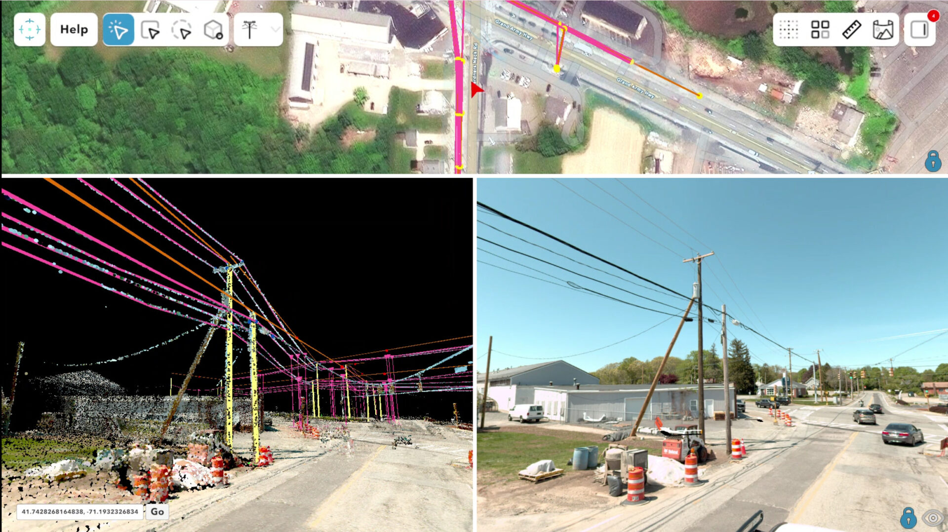
A breakdown of how vehicle-based mobile mapping and drone LiDAR differ in collection, accuracy, and data output, and why both feed cleanly into Ranger.
Two platforms, one extraction problem
LiDAR and imagery collection isn’t a one-size-fits-all decision. Vehicle-based mobile mapping systems and drone-mounted LiDAR sensors both produce georeferenced point clouds, but they get there through very different hardware, at very different scales, and with very different tradeoffs. Choosing the right platform, or the right combination of both, depends on the asset you’re capturing and the deliverable your client needs at the end.
Whichever platform generates the data, the harder problem has always been what comes next: accurately extracting the assets from the point cloud to generate engineering designs. That’s the extraction problem Ranger was built to solve, and it’s designed to take either data source in and produce the same consistent experience.
Mobile mapping: ground-level detail at corridor scale
A mobile mapping system mounts LiDAR sensors, high-resolution cameras, and a tightly coupled GNSS/IMU navigation unit on a vehicle, then drives the corridor. The GNSS and IMU are processed together, so the system keeps positional accuracy even through short GNSS interruptions like overpasses or tree cover.
Pros:
- High positional accuracy at speed. Well-calibrated vehicle systems routinely deliver 1–10 cm absolute accuracy, without lane closures or crews walking the right-of-way.
- Built for linear infrastructure. Roads, rail corridors, utility right-of-way, and pipeline routes are exactly what a driving platform is optimized to capture, often hundreds of miles in a single pass.
- Rich ground-level imagery. Panoramic and forward-facing cameras capture assets from the same eye-level perspective a field technician would see, which is valuable for sign legibility, pavement condition, and roadside asset inspection.
- No airspace restrictions. No FAA authorization, no weather-driven flight windows, no line-of-sight requirements.
Cons:
- Ground-level line of sight only. Anything set back from the road, hidden behind terrain, or blocked by other vehicles and vegetation simply won’t get scanned.
- Limited vertical perspective. Rooftops, tank tops, tower structures, and anything best viewed from above are outside what a vehicle-mounted sensor can see.
- Access-dependent. The system can only collect what the vehicle can drive. Off-road sites, construction interiors, and areas without vehicle access are out of reach.
The above video shows a fly-through of Riegl VMY-2 mobile mapping data.
Drone LiDAR: reach, density, and flexibility in hard-to-access terrain
Drone LiDAR puts a smaller, lighter sensor on a rotary or fixed-wing UAV, typically paired with RTK or PPK GNSS correction rather than a full tactical-grade IMU. Because the platform flies above the target rather than driving past it, it captures from angles and locations a vehicle never could.
Pros:
- Access anywhere within flight range. Off-road sites, steep terrain, construction sites, rail yards, and vegetated areas are all reachable without ground access.
- Very high point density over a target area. Slower flight speeds and tighter flight lines let drones achieve dense coverage, often well beyond what a moving vehicle can produce, which is valuable for detailed vertical structures and small-footprint sites.
- Top-down and oblique perspective. Roof lines, tank and tower structures, drainage and grading, and vegetation canopy are all far easier to capture from the air.
- RTK/PPK accuracy that competes with ground survey. With good satellite geometry and correction data, modern drone LiDAR reaches centimeter-level vertical accuracy.
Cons:
- Limited coverage per flight. Battery life and airspace constraints mean drones cover acres or a few miles per mission, not hundreds of miles in a day.
- Weather- and airspace-dependent. Wind, precipitation, and FAA Part 107 restrictions (controlled airspace, waivers, visual line of sight) can delay or block a collection window.
- Positioning is more sensitive to conditions. Without the tightly coupled, tactical-grade GNSS/IMU of a vehicle system, accuracy can degrade more in GNSS-challenged environments like dense tree canopy or urban canyons.
The video above shows Riegl drone LiDAR data.
Where the data outputs actually diverge
The pros-and-cons list matters because it shows up directly in the deliverable. A few of the biggest differences extractors and project managers should plan around:
- Point density and geometry. Drone LiDAR tends to deliver denser, more uniform coverage over a bounded area, especially on vertical and overhead surfaces. Mobile mapping delivers dense, high-fidelity coverage along the direction of travel, but density drops off with distance from the road and can leave gaps behind occluding objects.
- Perspective. Mobile mapping imagery is ground-level and forward/side-facing; drone imagery is nadir (straight down) or oblique. The same asset, a utility pole, for example, can look completely different depending on which platform captured it, which affects how it should be classified and attributed during extraction.
- Coverage footprint. Mobile mapping is built for linear, continuous corridors measured in miles. Drone LiDAR is built for bounded sites measured in acres. Combining both is common on projects that need both a corridor baseline and detailed capture of specific sites along it.
- File structure and metadata. Both platforms typically export to standard point cloud and imagery formats, but sensor calibration, trajectory data, and flight/drive-line structure differ enough that extraction tools need to normalize them before an extractor can work across both consistently.
One extraction platform for both
At New Compass, we know our clients are using a wide array of sensors for many different use cases, and we built Ranger to work for all of them. Ranger doesn’t care whether the point cloud in front of an extractor came from a vehicle-mounted system driving a highway corridor or a drone flying a substation site. Once the data is uploaded, project managers build a custom data dictionary tailored to the asset types and attributes the project requires, and extractors work in the same cloud-streamed, Unity-powered 3D environment regardless of source.
That consistency matters operationally. A team running both a corridor-scale mobile mapping collection and a set of drone LiDAR captures for specific facilities doesn’t need two extraction workflows, two sets of extractor training, or two QA processes. Ranger’s audit module applies the same statistical defect sampling and accuracy validation to both, and exports both to the same GIS-ready formats for delivery. Whether the source is a thousand-mile corridor or a fifty-acre site, the extraction environment, the quality bar, and the output format stay the same.
For a closer look at how Ranger handles mobile mapping and drone LiDAR data within our platform, contact the New Compass Solutions team to schedule a demo.