
Introduction
LiDAR technology has transformed the way organizations collect and analyze geospatial data. From infrastructure inspections and transportation planning to utility management and digital twin creation, LiDAR scans capture highly accurate three-dimensional information that supports better engineering and operational decisions.
But collecting the data, and even processing it into pano imagery and point clouds, is only part of the equation. Before that point cloud becomes something engineers, surveyors, and GIS professionals can actually use, it has to go through extraction: the work of identifying, classifying, and converting raw point cloud data into roads, poles, pavement markings, and every other real-world feature a project needs.
Traditionally, extraction has lived on the same high-performance desktop workstations used for processing, with massive datasets shuttled between machines, offices, and team members. Ranger changes that. As a cloud-native LiDAR feature extraction platform, Ranger moves the extraction workflow off individual workstations and into a shared, enterprise-grade environment, one built specifically to keep large datasets in place while making them easier to manage, extract from, and collaborate on.
The key to optimizing extraction workflows isn’t just in the actual feature extraction tools. It starts in finding the most efficient ways to organize and handle the massive datasets needed for accurate and usable extraction.
Traditional Desktop Extraction Workflows
For years, desktop software has been the default way to extract features from point cloud data. Surveyors and engineers download processed datasets onto powerful local workstations equipped with high-end processors, large amounts of RAM, dedicated graphics cards, and high-capacity local storage, then work through classification and feature extraction file by file, project by project.
That approach gives teams direct control over their tools, but it was built around a single person working on a single machine. As LiDAR asset extraction becomes the norm for the beginnings of engineering design, enterprise solutions are needed to handle the workload.
Where Desktop Extraction Breaks Down at Enterprise Scale
As datasets grow and teams get larger, desktop-bound extraction starts to show real cracks.
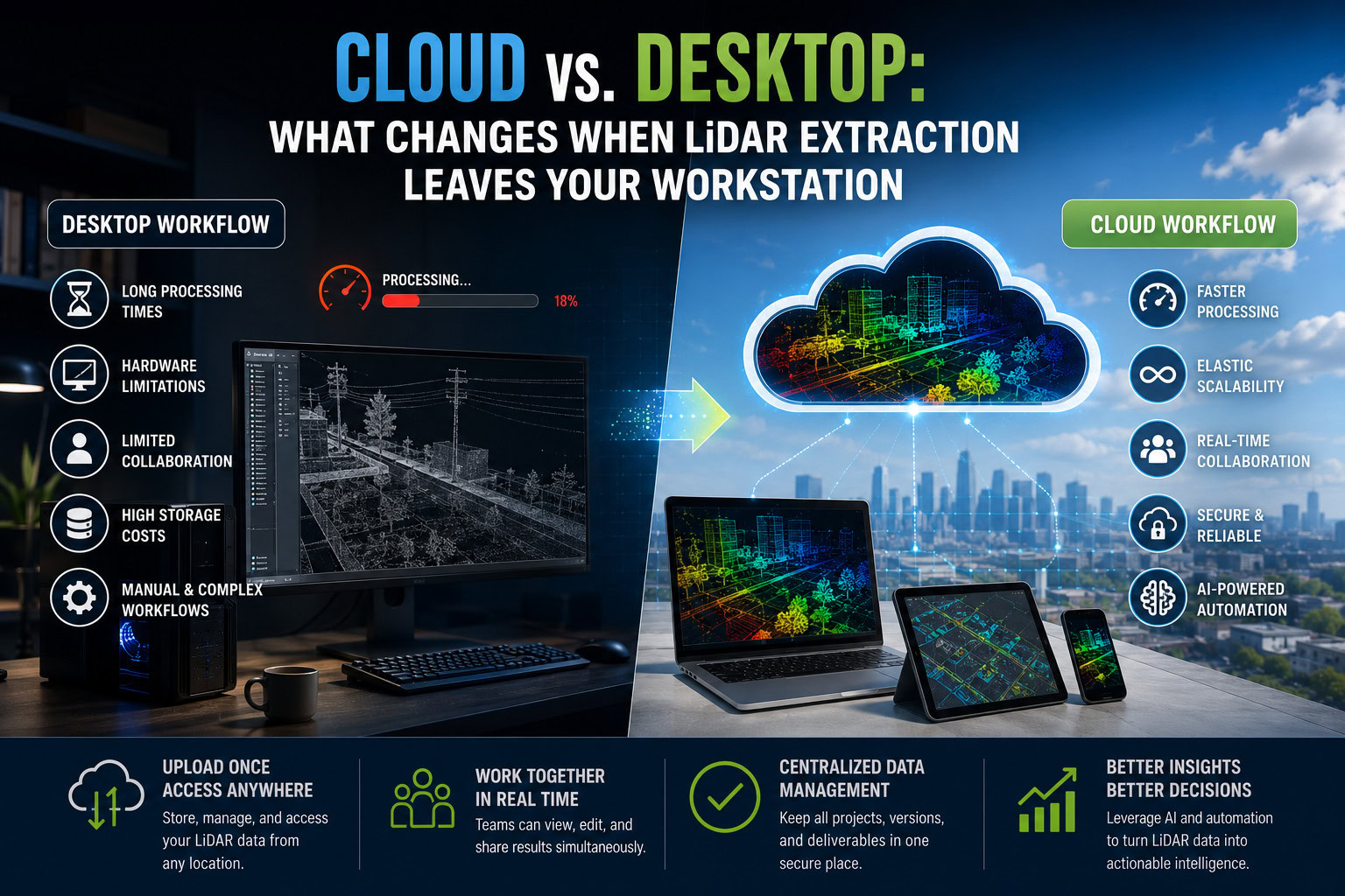
Datasets have to move constantly. Every time a project changes hands, someone is copying terabytes of point cloud data to a shared drive, an external hard drive, or a colleague’s workstation. That movement costs time, bandwidth, and, on large infrastructure projects, real money.
Collaboration means waiting in line. When a dataset lives on one machine, only one person can extract from it at a time. A second reviewer, a QA pass, or a second extractor working a different feature class usually means waiting for a copy, or waiting for a turn.
Version control becomes a manual job. Without a centralized system, teams end up tracking which copy of a dataset is current through file names and shared spreadsheets, a fragile system at enterprise scale.
Storage keeps climbing. Every duplicated copy of a multi-terabyte dataset is more local storage an organization has to buy, maintain, and back up.
Time is Lost. Downloading data to local workstations takes precious time. As design timelines continue to shrink, engineers cannot afford to wait around for their datasets to download to their computers in order to get their work started.
Each of these problems compound to huge losses of resources and time throughout a large-scale project. Newer approaches to data storage and access need to be adopted in order to meet the growing demand of modern engineering design projects.
Ranger: Extraction Without the Data Movement
Ranger is built around a simple premise: the dataset should stay stored in one location, and be accessible to everyone working on it, regardless of their location or hardware.
Because Ranger runs in the cloud, processed LiDAR datasets are uploaded once and accessed directly in a centralized, browser-accessible environment. There’s no repeated copying to individual workstations, no shuttling drives between offices, and no waiting for a multi-terabyte transfer to finish before extraction work can start. The dataset lives in one place, and every authorized user, regardless of location, works from that same source.
That single change removes one of the biggest hidden costs of enterprise LiDAR work: the time, bandwidth, and risk involved in moving massive datasets from person to person and project to project.
Built for Enterprise Collaboration
Because Ranger centralizes the dataset instead of the desktop, teams can work the way enterprise projects actually demand:
- Multiple extractors can work within the same project simultaneously, rather than waiting for a single workstation to free up or having to download a copy to their own workstation.
- Reviewers and QA staff can check extracted features against the live dataset without requesting a separate copy, and while extraction is still being completed.
- Project managers, engineers, and GIS analysts in different offices, or different companies, see the same data, updated in real time, rather than working from whatever copy happened to reach them last.
- Handoffs between extraction, review, and delivery happen inside the same environment, instead of across a chain of file transfers.
For organizations running multiple concurrent projects across distributed teams, this turns extraction from a series of individual efforts into a coordinated, enterprise-wide workflow.
Easier Data Management, by Design
Centralizing extraction in the cloud also solves the data management problems that desktop workflows push onto individual teams:
- Version control happens automatically, so there’s no question about which copy of a dataset is current.
- Access management lets organizations control exactly who can view, extract from, or edit a given project, down to the individual dataset.
- Backup and recovery are handled at the platform level rather than depending on whoever last remembered to back up a workstation.
- Storage scales with the platform, so organizations aren’t continually buying local storage to keep up with growing project archives.
The result is a dataset that stays accurate, secure, and current no matter how many people touch it, without an IT team building that infrastructure in-house.
Supporting Digital Twins and BIM
Extracted features feed directly into the systems that depend on them most: digital twins, Building Information Modeling (BIM), GIS platforms, CAD software, and asset management systems. Because Ranger keeps extraction centralized, the features flowing into those downstream systems stay synchronized across the full asset lifecycle, rather than diverging as different teams work from different local copies of the same project.
Why Enterprises Are Moving Extraction to the Cloud
Desktop extraction still has a place for smaller, single-user projects. But for enterprises managing large infrastructure programs (highway corridors, railway networks, utility transmission systems, smart city initiatives, municipal asset inventories, airport mapping, and industrial facilities), the calculus changes. These projects generate enormous datasets, involve distributed teams, and demand tight coordination between extraction, review, and delivery.
Ranger was built for exactly that environment: a place where the dataset doesn’t move, the team doesn’t wait, and the data stays managed and current no matter how many hands are on it.
The Future of Cloud LiDAR Extraction
The geospatial industry is moving toward connected, cloud-first extraction workflows, and the direction is only accelerating: real-time cloud extraction, automated quality assurance, integrated digital twins, browser-based point cloud visualization, and seamless GIS integration are all becoming table stakes rather than differentiators.
Platforms that keep data centralized, rather than distributed across individual workstations, are the ones positioned to take full advantage of those advances as they arrive.
Conclusion
Moving LiDAR feature extraction from individual desktop workstations to a centralized cloud platform is about more than raw speed. It’s about removing the friction that comes from moving massive datasets between people and machines, and replacing it with a single, well-managed source of truth that an entire enterprise can extract from, review, and build on together.
For organizations managing growing volumes of geospatial data across distributed teams, Ranger offers a way to extract more value from every LiDAR dataset without the overhead of moving it, duplicating it, or losing track of which version is current.